
KiwiArc Logo
KiwiArcTM
Interactive Travel Itinerary Map
Interactive Maps

Interactive Travel Itinerary Map

Year2026
ClientDemonstration
IndustryTravel & Tourism
Project DurationN/A
Live Project

Intro

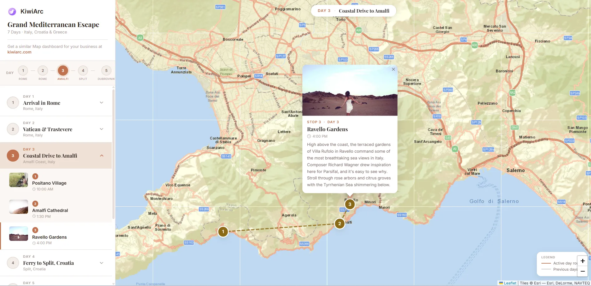
An interactive travel planning map that connects a day-by-day itinerary with mapped destinations, routes, and detailed location information. Users can explore each day's journey and select individual stops to view photos and descriptions.

Project Screenshot

Objective

To turn a multi-day travel plan into an easy-to-explore visual itinerary where destinations, routes, and daily activities are connected directly to the map.
Key Features

  • Day-by-day itinerary
  • Interactive route visualization
  • Numbered destination markers
  • Individual stop details
  • Location photos and descriptions
  • Interactive map popups
  • Previous/active route visualization
  • Map zoom and navigation controls

Technologies

HTMLCSSJavaScriptLeafletOpenStreetMap / Esri

Categories

Interactive MapsTravel MappingMap Visualization

Latest Projects