KiwiArc Logo
KiwiArcTM

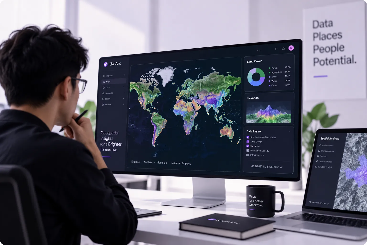
Transforming complex data into clear spatial insights.

SERVICES

What We Do

Explore what we can do for you

01

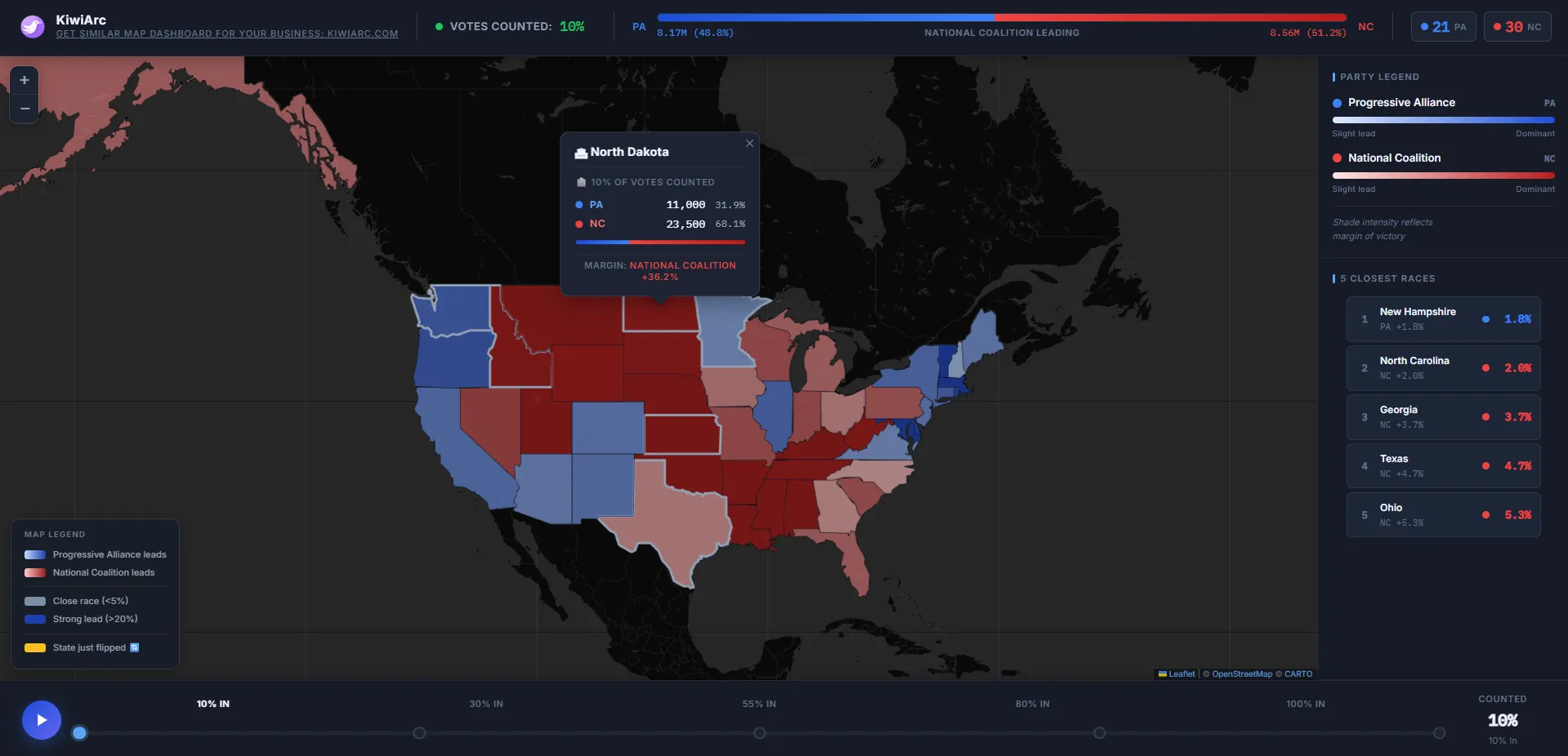
INTERACTIVE MAPS

Web Mapping

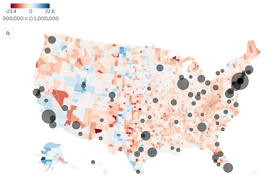
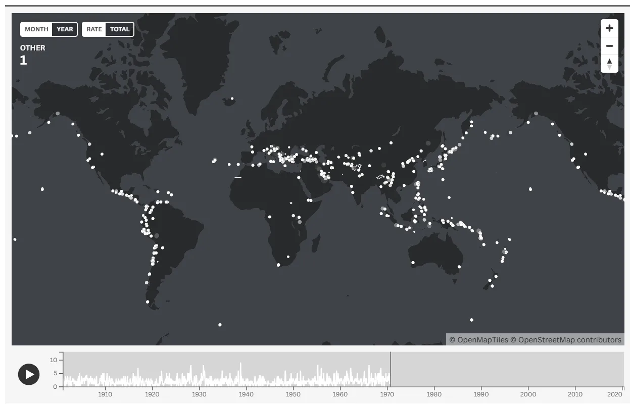
We build high-performance interactive maps for websites, research portals, and organizational platforms. Designed to be fast, responsive, and easy for your audience to explore without requiring specialized software.

View Projects

Capabilities

  • Custom Mapbox / Leaflet Integration
  • Vector Tile Rendering
  • Interactive Points of Interest
  • Data Filtering & Overlays
02

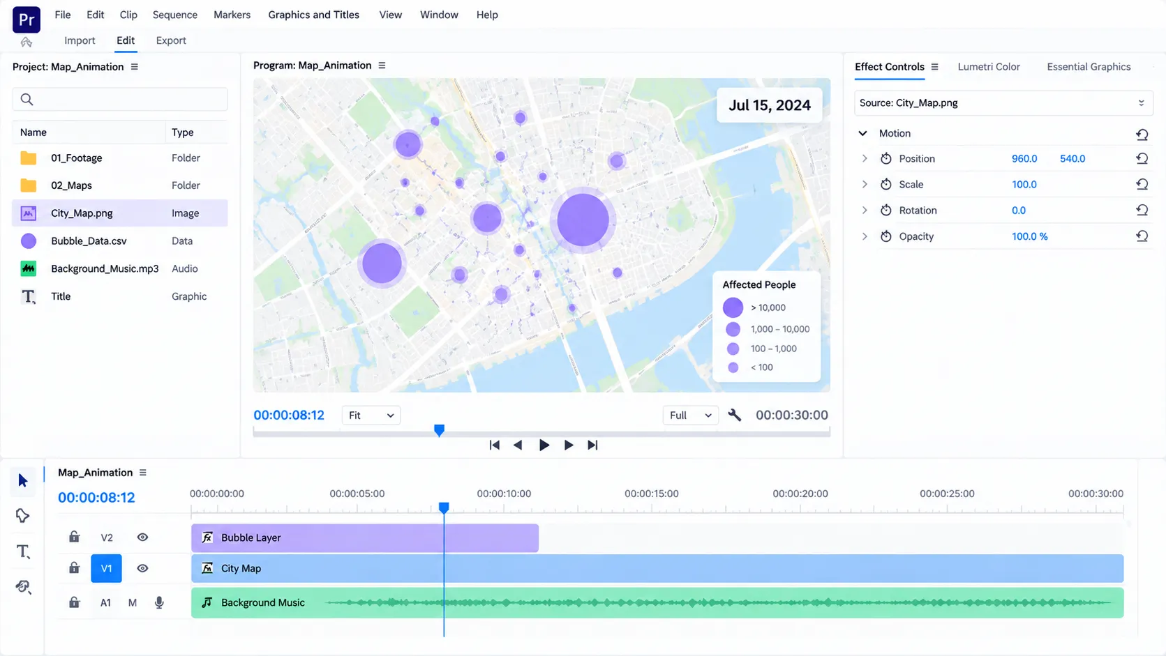
MAP ANIMATION

Motion & Storytelling

Animated maps that explain movement, timelines, and geographic change with smooth, presentation-ready visuals. Perfect for documentaries, marketing videos, and keynote presentations.

View Projects

Capabilities

  • 2D & 3D Fly-throughs
  • Historical Timelines
  • Route & Flow Animations
  • Broadcast-Ready Exports
03

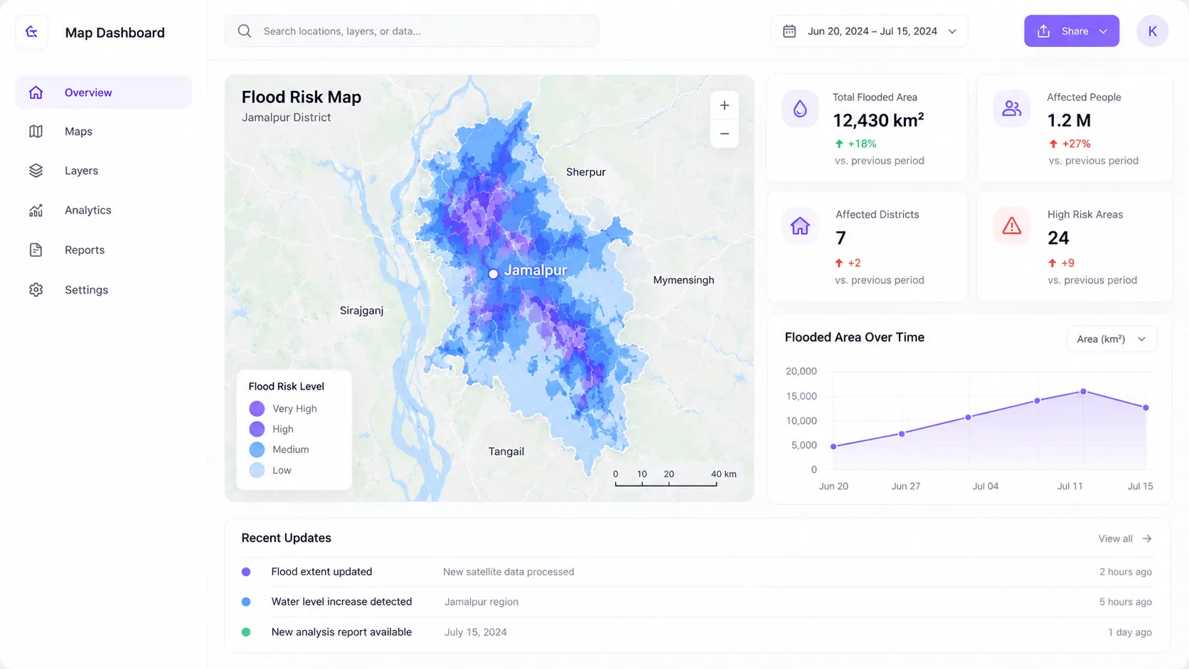
WEB DASHBOARDS

Data Visualization

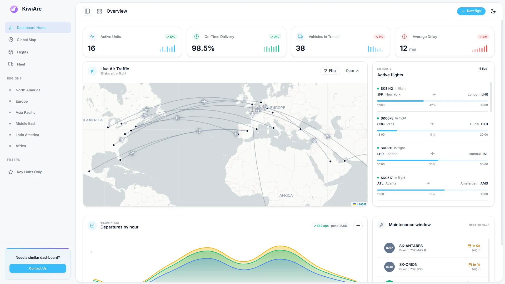
Interactive dashboards that combine maps, charts, and key performance indicators into one clean interface. We turn complex datasets into actionable, real-time reporting tools.

View Projects

Capabilities

  • Geospatial BI Panels
  • Real-time Data Feeds
  • Custom Charting (D3/Recharts)
  • Secure Access Controls
04

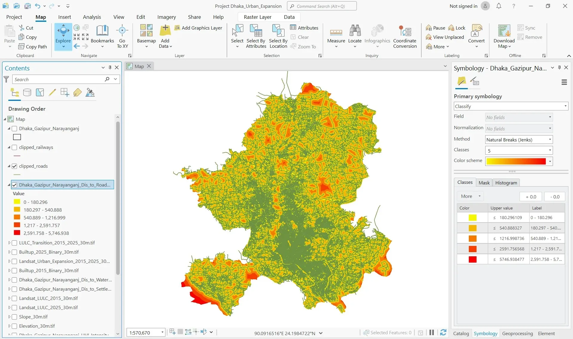
GIS & REMOTE SENSING

Spatial Analysis

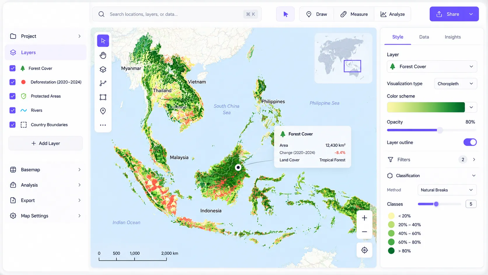
Advanced spatial analysis, satellite imagery processing, terrain modeling, and publication-ready GIS outputs for researchers, urban planners, and environmental organizations.

View Projects
Capabilities

  • Satellite Image Processing
  • Topographic & Terrain Modeling
  • Suitability Analysis
  • Static Publication Maps
Our Process

Strategic steps to impactful results

Process visualization
Phase 01

Discovery

Understanding goals, audience, available data, and project objectives.

Phase 02

Data Preparation

Organizing datasets, cleaning information, and preparing technical foundations.

Phase 03

Design & Development

Creating interactive maps, dashboards, animations, or GIS solutions with continuous collaboration.

Phase 04

Review & Refinement

Testing, gathering feedback, making revisions, and polishing every detail.

Phase 05

Launch & Support

Final delivery, deployment, documentation, and optional long-term support.

Built with Professional Tools

The right tools
for every project.

Interactive Maps

Interactive Maps
Mapping
LeafletMapboxOpenStreetMapTurf.jsPostGISMapLibre
Frontend
HTMLCSSJavaScriptReactNext.jsTailwindCSS
Deployment
GitHubCloudflareVercelAWS

Map Animation

Map Animation
Animation
After EffectsBlenderFFmpegCinema 4DLottie
Development
HTMLCSSJavaScriptGSAPThree.jsFramer Motion
Graphics
Adobe IllustratorPhotoshopFigma

Web Dashboards

Web Dashboards
Dashboard Platforms
Power BITableauExcelMetabaseSuperset
Visualization
Chart.jsD3.jsRechartsPlotly
Programming
PythonSQLRJavaScriptTypeScript
Data
PostgreSQLBigQuerySnowflake

GIS & Remote Sensing

GIS & Remote Sensing
GIS
ArcGIS ProQGISArcGIS OnlineGDALPostGISWhiteboxTools
Programming
PythonGeoPandasRasterioNumPyPandasR
Remote Sensing
Google Earth EngineSentinel-2LandsatMODISPlanet Labs
Trusted By
AIRE+ Partners
Buen Capital Partners
JSX
North West Place
Northwestern Medicine
The AZEK® Company
Vertical Recruitment
AIRE+ Partners
Buen Capital Partners
JSX
North West Place
Northwestern Medicine
The AZEK® Company
Vertical Recruitment
AIRE+ Partners
Buen Capital Partners
JSX
North West Place
Northwestern Medicine
The AZEK® Company
Vertical Recruitment
AIRE+ Partners
Buen Capital Partners
JSX
North West Place
Northwestern Medicine
The AZEK® Company
Vertical Recruitment
Client Testimonials

Built with clients,
trusted through results.

Real feedback from researchers, businesses, startups, and organizations we've collaborated with.

ClientClientClientClient
Client-first collaboration

"Very good work. He added all the necessary details and made everything exactly as requested."

Sarah Jenkins
Sarah Jenkins
Operations ManagerNorthwestern Medicine

"Hire him. He and his team are spectacular."

David Chen
David Chen
Founder & CEOThe AZEK® Company

"Excellent, professional, knew how to navigate the project without much instruction"

Elena Rodriguez
Elena Rodriguez
Senior Geospatial AnalystJSX

"I honestly can't give enough praise to the quality of work. Helped me with exactly what I needed, was polite, professional, and prompt. Will absolutely bring more work in the future and recommend to others."

Marcus Thorne
Marcus Thorne
Director of EngineeringBuen Capital Partners

"It was a pleasure working with! great communication, professional working standards and in-time delivery. Would definitely hire again."

Priya Patel
Priya Patel
Technical LeadAIRE+ Partners

"Very professional, great communication and flexible creating quality data visualizations. Highly recommend."

James Wilson
James Wilson
Head of DataNorth West Place